Where Can I Fly My Drone in the UK? (Without the Toxic Facebook Pages)
You’ve done it. The delivery driver has just handed over the box. You’ve peeled off the plastic, charged the batteries, and you have been waiting for this moment. You're excited about your new hobby, or maybe you're just looking for something you can do with the kids to get them outdoors and away from their games consoles.
But you also want to do things right. You’re a responsible person! You don't want to accidentally shut down an airport, annoy your neighbours, or get yourself into bother with the long arm of the law!
So, you do what any modern person does: you turn to the internet. You find a popular UK Drone Facebook page, join up, and type out an innocent, well-meaning question:
“Hi everyone! New to the hobby. I’ve got a Mini 4 Pro, can I fly it in my local park?”
You hit 'Post', expecting a warm welcome, some friendly advice, and maybe a few tips to help you get started safely.
What you actually get is a sledgehammer to the face.
Enter the "Experts"
Within three minutes, your notifications light up. But it isn't a warm welcome. It’s an onslaught.
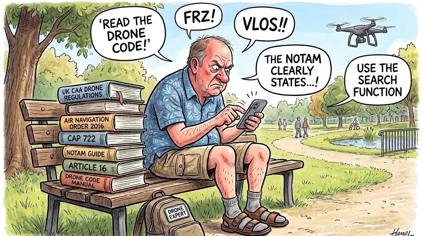
Before you can even blink, you are cornered by angry, red-faced people—presumably typing furiously whilst wearing socks and sandals—screaming a barrage of acronyms you’ve never heard of.
"HAVE YOU EVEN READ THE DRONE CODE?" one shouts in all caps.
"WHAT ABOUT YOUR TOAL? ARE YOU MAINTAINING VLOS?!" demands another.
"Expect a visit from the CAA, mate," chimes in a third. "If you can't read the rules then you shouldn't be in the air!"
Suddenly, someone drops a link to a terrifying, highly complex airspace map covered in forty-seven overlapping red circles, yellow polygons, and warning text that looks like a nuclear launch sequence.
And then, the ultimate insult, the battle cry of the forum gatekeeper: "USE THE SEARCH BAR!!!"
The Reality Check
Look, the rules are important. The UK has strict aviation laws for a reason, and airspace restrictions, local byelaws, and ground hazards are no joke. The problem isn't the rules; the problem is how they are delivered.
Aviation complexity doesn't have to be a weapon used to bash new pilots over the head. You shouldn't need a law degree or a secret decoder ring just to figure out if you can take a nice photo of the local park without breaking the law.
When you ask, "Can I fly here?", you don't need a lecture on the history of drone legislation. You just need to know if the airspace is clear, what the weather is doing, and if the local council has banned taking off from the grass.
The "Can I Fly Here?" Cheat Sheet
Before you launch, it helps to know what the angry people on Facebook are actually shouting about. Here is your quick translation guide to the most important checks:
🚨 No Fly Zones (Stay Away: Here Be Dragons)
If you ever look at a traditional drone map, these areas are almost always coloured an angry, bright red. These zones are highly dangerous, and taking off inside one is usually strictly illegal. It typically means there is a busy airport, an active military base, or a prison right next to you.
The Acronyms They’ll Yell At You:
- FRZ (Flight Restriction Zone): The big red zones around airports where commercial jets live. You absolutely cannot fly here without permission from Air Traffic Control. The local police will not accept "I just wanted a cinematic shot of the Ryanair flight" as an excuse.
- Danger, Restricted, or Prohibited Areas (EGD / EGR / EGP): Military firing ranges, nuclear power stations, and places the government really doesn't want you pointing a 4K camera at. (Pedant note: Yes, Danger areas can technically be flown if you prove they are inactive, but for a beginner? Just stay away).
🌩 Temporary Bans (The Invisible Walls)
Sometimes the sky is completely legal on Monday, but illegal on Tuesday. On traditional drone maps, these temporary changes are often shaded in amber.
The Acronyms They’ll Yell At You:
- NOTAM (Notice to Aviation - though the old guard still call it Notice to Airmen): A temporary warning that something unusual is happening in the sky. Some NOTAMs enact strict temporary flight bans (like a VIP helicopter route or an airshow), whilst others are merely warnings to be careful (like a tall crane being erected). Traditional maps show these as massive blocks of confusing, capital-letter text that look like a 1980s computer error code.
📍 Ground Rules & Environmental (Proceed With Caution)
Just because the sky is clear doesn't mean the ground is. You might be legally allowed to fly over a park, but the local council might have banned you from standing on the grass to control the drone. Furthermore, traditional maps often mark environmental areas in green. Be careful: green doesn't mean "100% safe to fly"—it means proceed with caution and respect the local rules!
The Acronyms They’ll Yell At You:
- TOAL (Take Off and Landing): A fancy way of saying "where you are standing when you put the drone on the ground." You technically need permission from the landowner to TOAL.
- VLOS (Visual Line of Sight): You must be able to see your drone with your own eyes at all times. Staring at the screen on your controller while the drone is a speck on the horizon doesn't count!
- SSSI / SAC / SPA: This alphabet soup stands for protected environmental and wildlife sites (like Sites of Special Scientific Interest). To be clear: these are never aviation "no-fly zones" because only the CAA controls the airspace. However, the law strictly prohibits disturbing protected wildlife. If your flight causes distress to animals or nesting birds, you are committing a wildlife offence. You must proceed with extreme caution and respect the environment.
There is a Better Way
That’s exactly why we built QuickSpotCheck.
We took all the pedantic precision, all the complex aviation data, and all the strict legal requirements, and we put them behind the scenes. We do the heavy lifting so you don't have to.
Instead of wading through a swamp of toxic Facebook comments or trying to decipher overlapping map polygons and 500-word NOTAMs, you just open the app and run a quick scan. You get the actual flight data you need—airspace restrictions, weather conditions, and ground rules—translated into plain, understandable English.
It’s legally correct, incredibly precise, and—best of all—it won't yell at you in acronyms.
Leave the socks-and-sandals brigade to argue in the comments. You’ve got some flying to do!