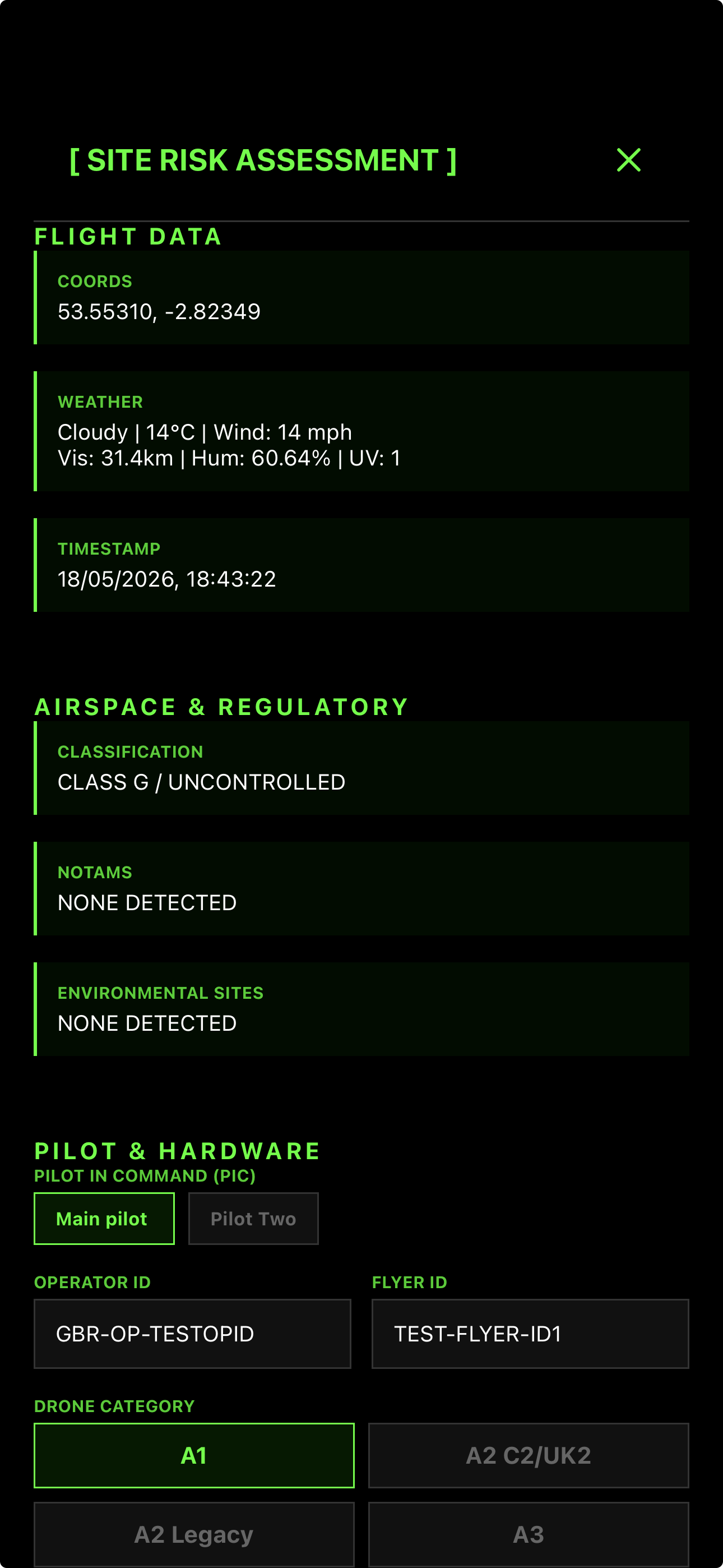
Comprehensive Hazard Detection
We don't just show a map. QuickSpotCheck instantly analyzes your exact launch coordinates against official NATS airspace, SSSI environmental boundaries, local council rules, and ground-level hazards.
- Official NATS eAIP Data
- SSSI, SAC & SPA Boundaries
- Local Council Byelaws
- Localised Geographical Hazards
- Social Friction Points
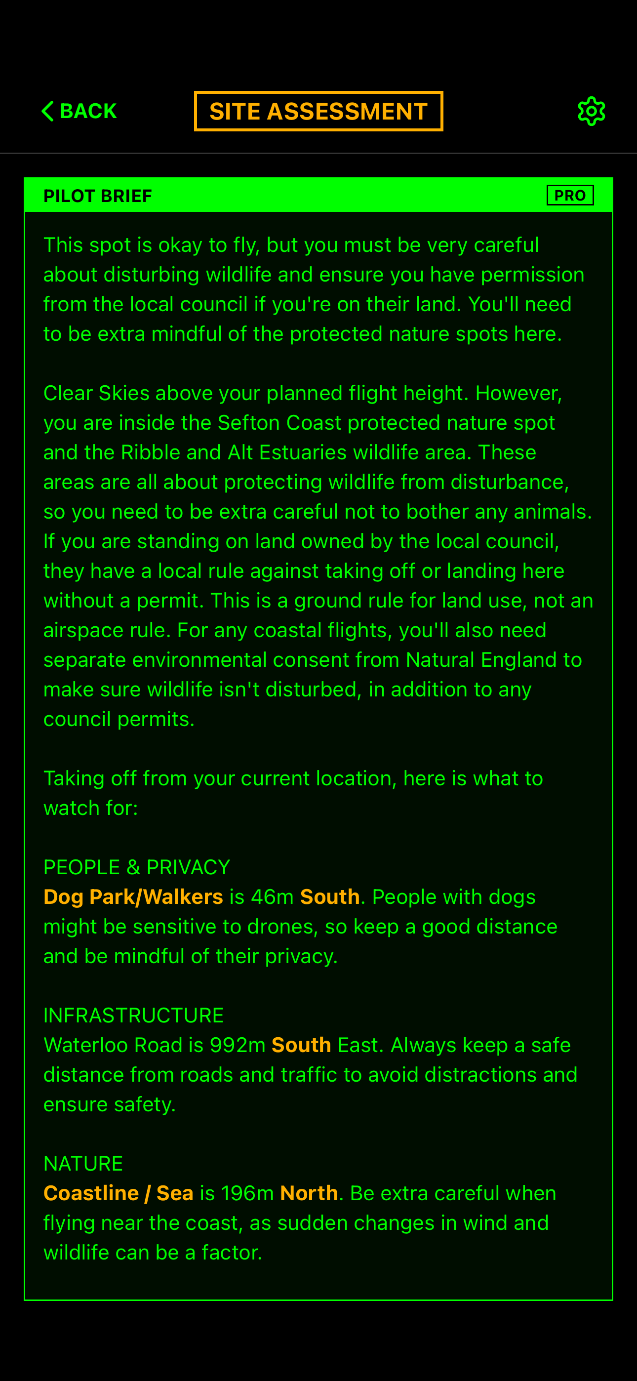
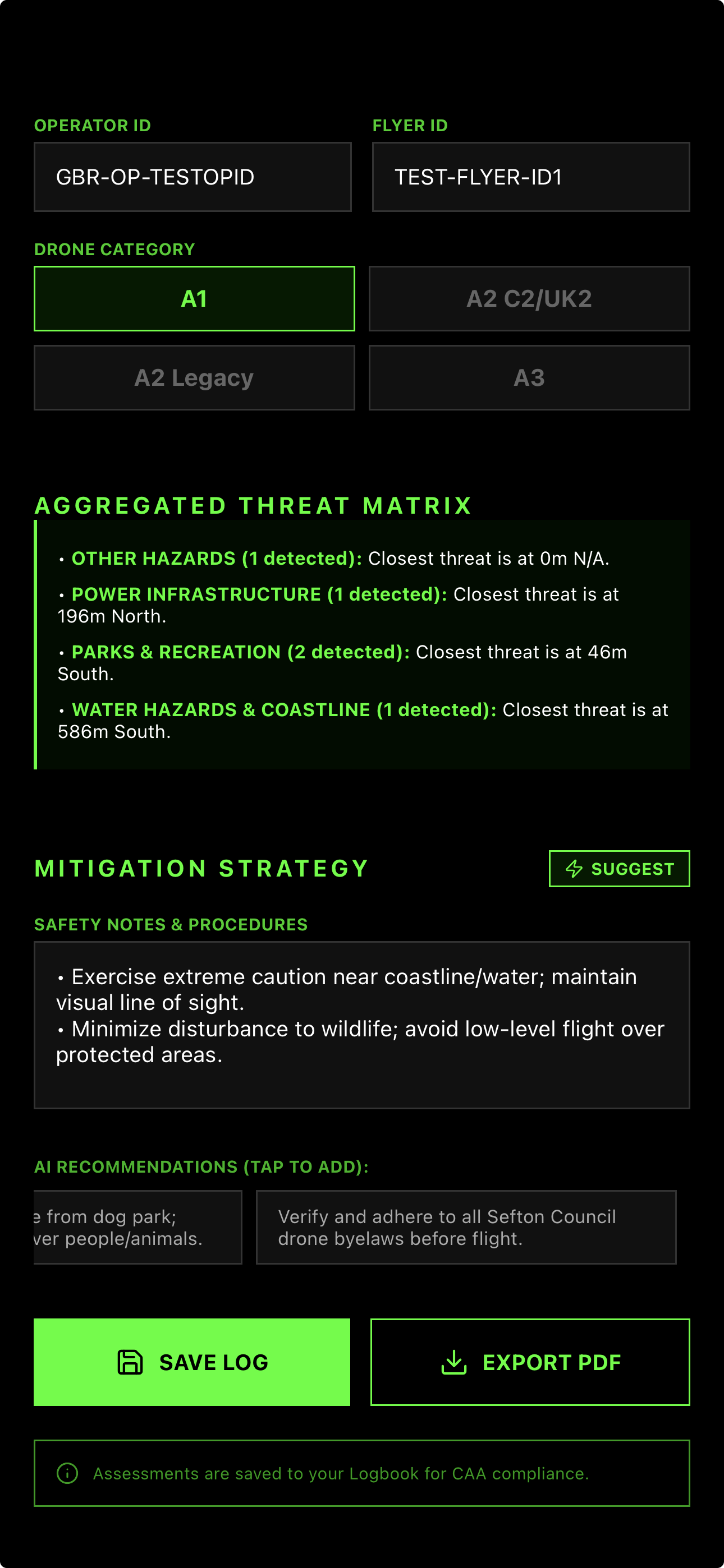
Intelligent Mitigation Suggestions
Stop copying and pasting generic risk assessments. Our AI analyzes the specific hazards detected at your launch site and generates tailored mitigation bulletpoints for your team to review, refine, and adopt.
AI-Generated Analysis:
- • PROXIMITY TO SCHOOL: ADVISE FLIGHT OUTSIDE OF OPERATIONAL HOURS.
- • WATER HAZARD DETECTED: ENSURE RTH POINT IS SET TO DRY LAND.
- • SSSI NEARBY: MONITOR ALTITUDE TO PREVENT BIRD DISTURBANCE.
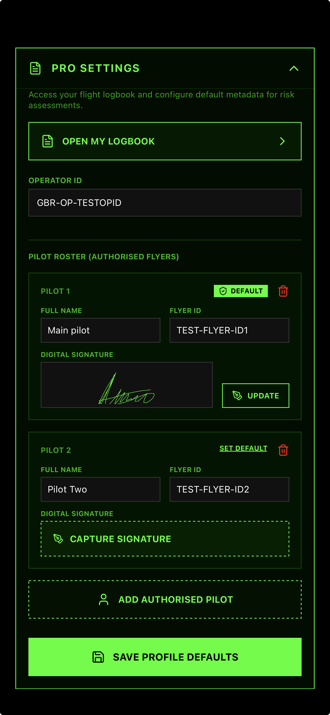
The Paperless Flight Line
Ditch the clipboard. Add instructors, students, or crew members to a digital roster. Each pilot reviews the brief and signs off directly on the device, ensuring absolute accountability before takeoff.
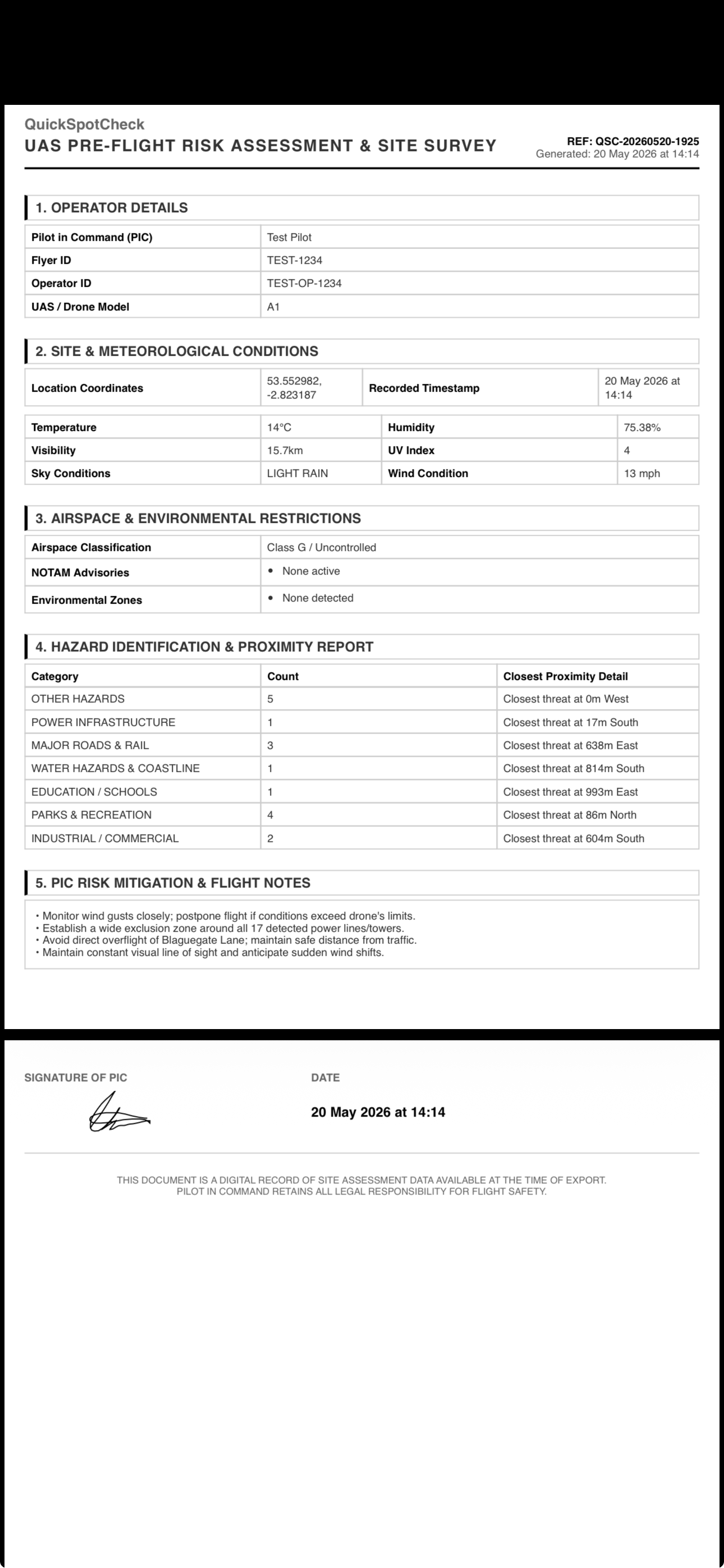
Audit-Ready Documentation
With one tap, export the entire briefing, hazard list, mitigations, and digital signatures into a timestamped, uneditable PDF. Perfect for your compliance records, client reports, or training logs.